ixGeo
Delphi · FireMonkey · Native mapsOffline vector maps inside your Delphi application.
ixGeo renders maps directly in a FireMonkey control using Skia. No browser, web view or tile server is needed. Local .ixgeo map files bring streets, buildings and points of interest into your application, even without an internet connection.
Development update · 18 November 2026
These additions describe the current development build. Updated demo archives and a new demonstration video are being prepared.
- Native maps and styles. 2D and 2.5D views, buildings with roofs and shadows, trees, X-ray visibility around objects, and OSM, Paper and Sketch styles.
- Globe and camera. World relief, country names and colours, country highlighting, night lights, and smooth FlyTo transitions from the globe to street level.
- Relief and optional map data. Add detailed coastline, terrain heights, sea depths and nautical marks as separate files. Display hill shading, slope colours and depth contours; query elevation and route profiles with ascent and descent.
- Objects, flights and orbits. Moving markers, animated walkers, camera following and geofences, plus flight paths, great-circle arcs, satellite orbit animations and trails. Customise marker outlines, pulsing bases and selection rings, or drag markers on the map.
- Search and routing. Local search for places, streets, addresses and countries; car, bicycle and walking routes. Travel-time estimates account for turns, traffic lights and stop signs. Drag a route to another street to add a via point.
- Nautical layers. Optional S-57 ENC, OpenSeaMap and Nutimeri data: navigation marks, light sectors, hazards, anchorages and restricted areas. Lights can flash to their recorded rhythm; clicking a mark reveals its attributes.
- Your own map content. Draw and edit points, lines and areas; measure distances and areas; load and save GeoJSON layers. Routes placed on the ground pass beneath buildings.
- IX Geo Studio and the library. Prepare map data, edit styles and markers, and save add-on and display settings in projects. The library reads maps through its own IxDAC layer; UniDAC is not required for the library.
Search, routing, relief and nautical detail depend on the map files and optional data you supply.
Screenshots
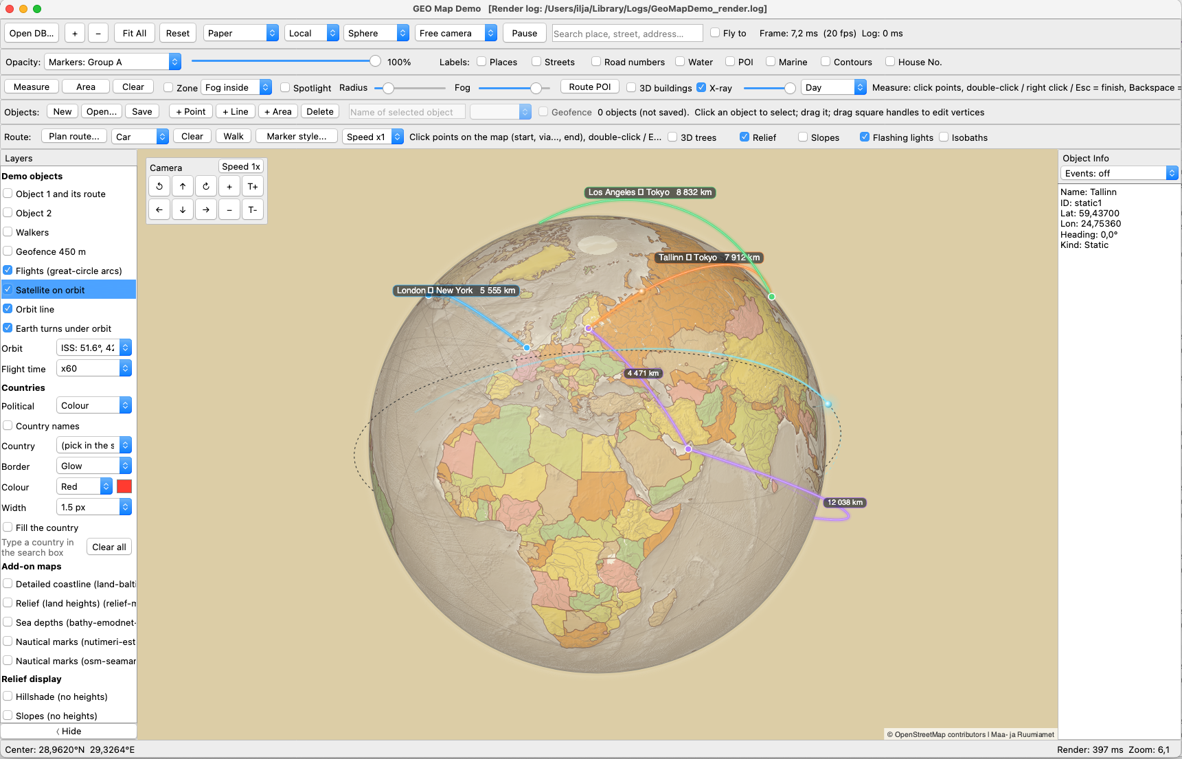
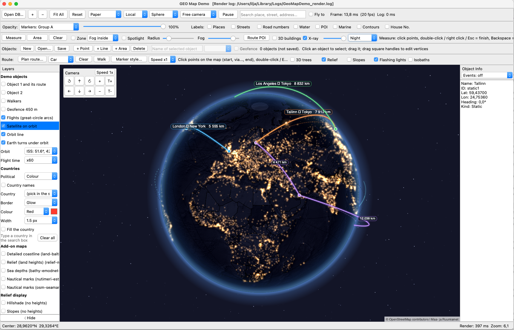
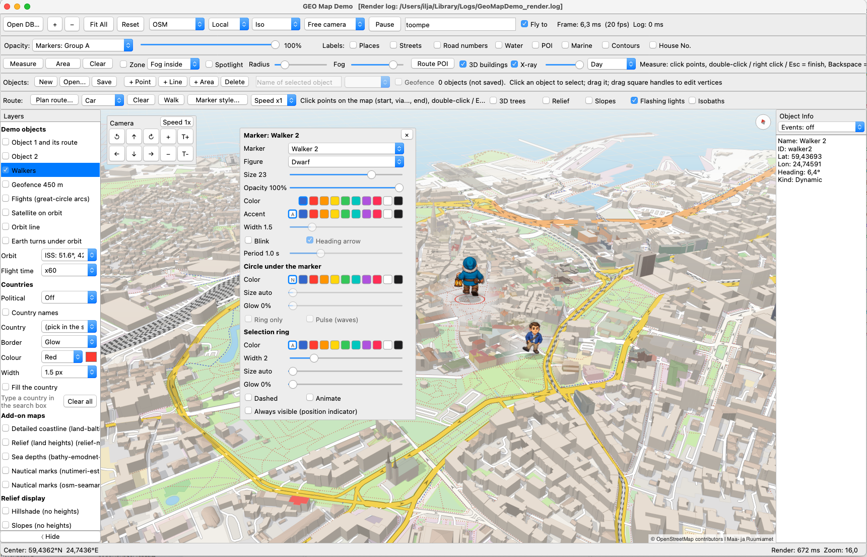
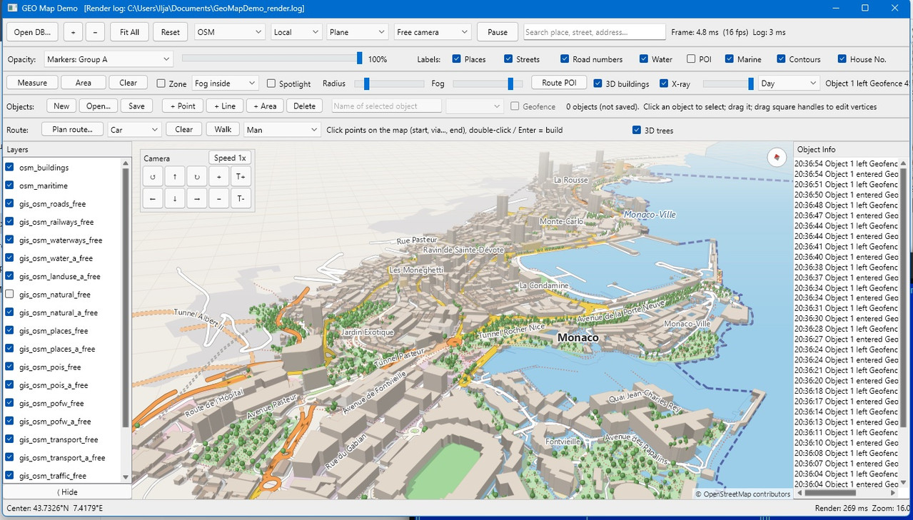
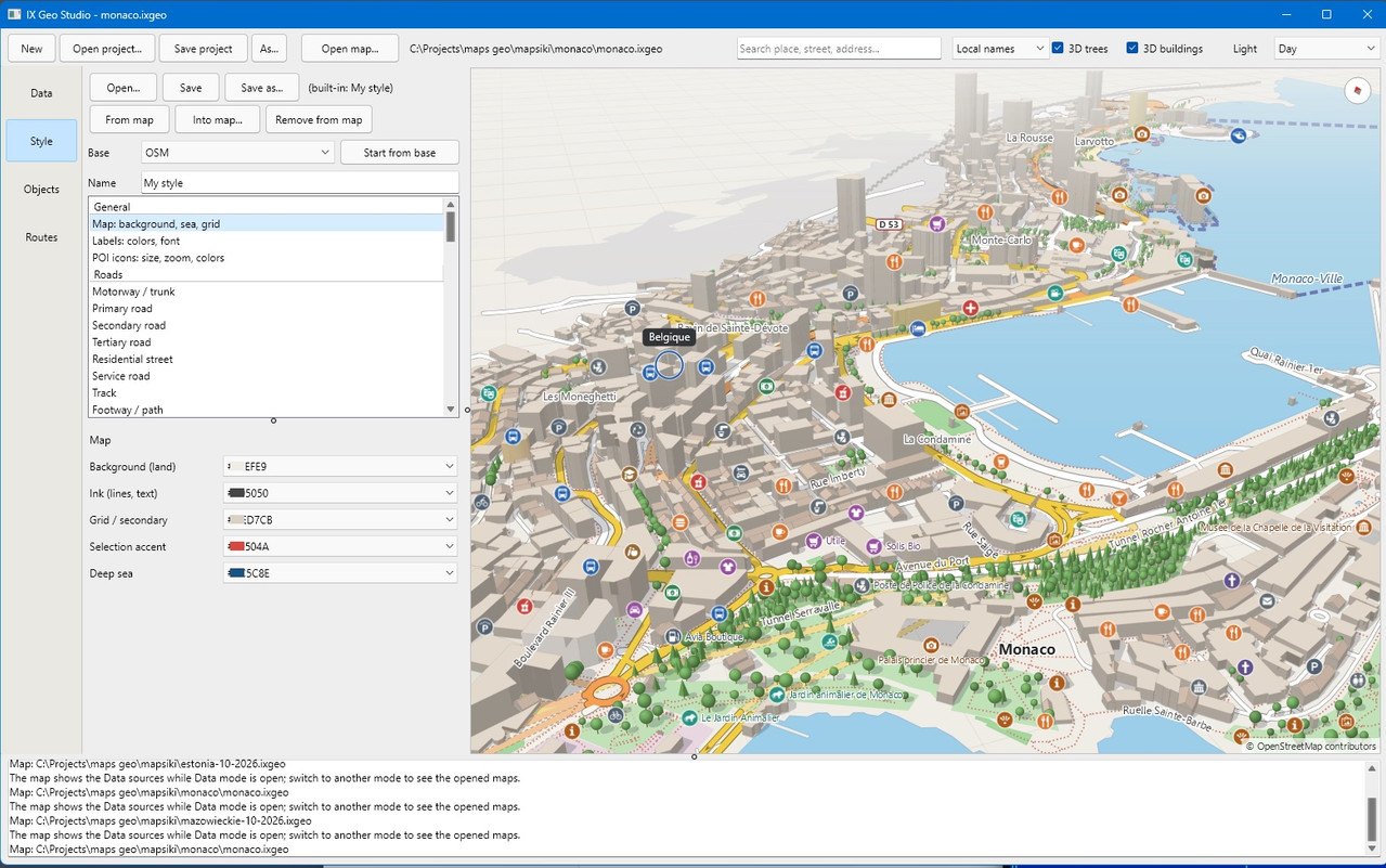
Click a screenshot to open the original image in a new tab.
Map data © OpenStreetMap contributors.
Pricing and licence
| Edition | Per developer | 12-month renewal |
|---|---|---|
| BinaryCompiled library | €990 | €390 |
| SourceLibrary source code | €2 990 | €1 190 |
Prices are in euros, per named developer, excluding VAT and other applicable taxes.
The first purchase includes perpetual use of the versions received and 12 months of updates and standard support. Renewal is optional: you may continue developing and distributing applications with your purchased version after updates expire.
Both editions offer the same library functionality, examples with source code, documentation, and ready-to-run Studio and converter tools. Source additionally includes the library source code for debugging, modification and rebuilding. Source code for Studio, the converter and other tools is not included.
Licence and support details
Compiled applications may be distributed without per-copy royalties. The library and its source code may not be redistributed or resold as a component or SDK. Map data and third-party materials retain their own licences. Each developer needs a licence; use on that developer’s computers and dedicated CI builds is allowed.
Standard support covers reproducible bugs and questions about the documented API. Custom development, integration work, guaranteed response or fix times and SLA are quoted separately. Binary compatibility is limited to the Delphi versions and platforms listed for the supplied build.
Upgrade from Binary to Source during active support: pay the current price difference (€2,000 at these prices); the support end date stays unchanged. On-time renewal adds 12 months after the current period. After a break, renewal starts a new 12-month period from payment, without charges for skipped years.
For teams of three or more developers, OEM terms or an invoice, contact us.
Request a licence →Questions about ixGeo or integration? Contact us